
Exit Glacier
Before heading back to Anchorage we decided to visit Exit Glacier just north of Seward.
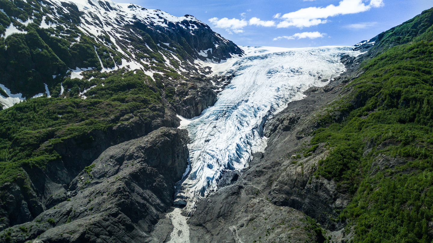
The road to Exit Glacier is 3 miles north from the north side of Seward. It’s another 9 miles from the Seward Highway to the glacier parking lot. Exit Glacier sits near the border of Kenai Fjords National Park and Chugach National Forest. Water runoff feeds into Resurrection River and eventually makes its way down to Resurrection Bay. The quick drive is just another in Alaska that left us at a loss for words. We stopped at a couple different pull offs to take pictures and just enjoy the view.
The second pull off we took was a view point of Exit Glacier. With a row of trees a few feet below the edge of the parking lot, a river past that, and the glacier two miles straight ahead with no obstructions, it allowed for a wide open view of the glacier. From where we were standing it was hard to believe something that looked so close was actually a full two miles away as the bird flies. Ben was able to fly the drone for an arial view of the glacier before we drove into the park. We almost learned just how accurate the drone is at estimating how much flight time is left on a battery. Down where we stood the winds were light to nonexistent, but closer to the glacier they were strong. This meant the drone had to work harder to stay in one spot which meant more battery usage than in optimal flying conditions. Fortunately, the drone made it back with battery to spare and Ben got some amazing photos and video out of it.
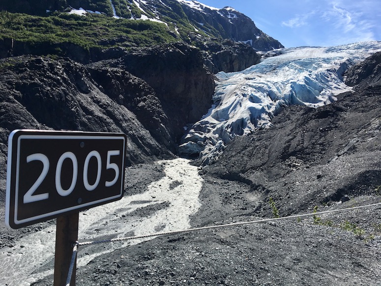
Once you cross the border into the Kenai Fjords National Park you’ll notice sign posts along the road with a year on them. These posts designate where the tip of the glacier was at the year on the post. The first post after the park sign is 1815. Some posts were only 20 years apart, while others were 40 or more. At the edge of the glacier was a sign post for the year 2005. Standing next to it looking at the glacier really gives you an appreciation for how far the glacier has receded in the last 12 years.
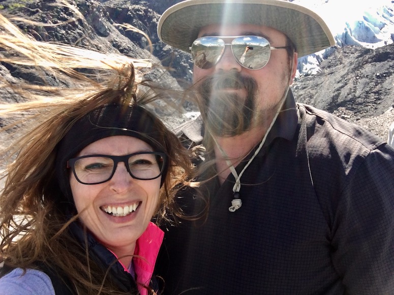
We decided to take the 0.6 mile hike to the glacier’s edge from the Nature Center. Almost completely uphill, the hike took maybe 20 minutes counting pauses to allow people to pass in narrower sections. The hike was pretty easy aside from the uphill aspect. Just be sure to watch for loose gravel in some sections so you don’t slip! On the trail we got fairly warm with the sun on us and no wind. I started to regret wearing long sleeves and a vest. Until we got to the glacier edge. At the edge of the glacier where the trees break, the wind kicks up. And I mean kicks up. I had to hold my hair down to take photos and the temperature must have dropped at least 15 degrees. All of a sudden I was incredibly happy to have my vest, and even that almost wasn’t enough.